Curriculum – Geography
At Lumley Junior School, we use the National Curriculum for Geography as the basis of our Geography programme.
The National Curriculum for Geography aims to ensure that all pupils:
- develop contextual knowledge of the location of globally significant places – both terrestrial and marine – including their defining physical and human characteristics and how these provide a geographical context for understanding the actions of processes
- understand the processes that give rise to key physical and human geographical features of the world, how these are interdependent and how they bring about spatial variation and change over time
- are competent in the geographical skills needed to:
- collect, analyse and communicate with a range of data gathered through experiences of fieldwork that deepen their understanding of geographical processes
- interpret a range of sources of geographical information, including maps, diagrams, globes, aerial photographs and Geographical Information Systems (GIS)
- communicate geographical information in a variety of ways, including through maps, numerical and quantitative skills and writing at length.
In Key Stage Two, we aim to equip children with geographical knowledge about diverse places, people, resources and natural and human environments, together with a deep understanding of the Earth’s key physical and human processes. We intend to inspire in pupils a curiosity and fascination about the world and its people which will remain with them for the rest of their lives.
Knowledge and Key Skills Progression Grids:
GEOGRAPHY – KS2 Knowledge and Key Skills Progression – updated September 2023
Implementation
We provide pupils with the knowledge and key skills of: use of geographical information from maps, atlases and globes; use of fieldwork and observations skills to observe, measure and record and geographical communication. Lessons are adapted where necessary to meet the needs of pupils including those with special educational needs and disabilities.
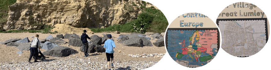
Our Geography curriculum is enquiry-based and we hope for our pupils to gain in-depth knowledge and skills which are progressive and transferable. To ensure progression, pupils begin by focusing on our local area and the UK, progress onto Europe and then the world. Geography lessons are practical in nature and appropriate use is made of maps, atlases and globes as well as photographs and field study to ensure children are engaged and enthusiastic about geography.
Impact
By the end of Key Stage Two most children will:
Locational Knowledge
- Know and locate County Durham, Great Lumley and the North East on maps.
- Name and locate key cities and rivers of the Uk, Europe and the world.
- Know there are over 40 countries in Europe.
- Know there are 195 countries in the world.
- Identify the position and significance of latitude, longitude, Equator, Northern Hemisphere, Southern Hemisphere, the Tropics of Cancer and Capricorn, Arctic and Antarctic Circle, Prime / Grenwich.
- Know and locate the Amazon Rain forest.
Place Knowledge
- Name some rivers in the UK.
- Identify similarities and differences between Great Lumley and Newcastle and Seaham.
- Compare the NE t a region in Italy.
- Compare Hamsterly forest to the Amazon Rain forest.
Human and Physical Knowledge
- Name human and physical features in Great Lumley, Durham, North East, Europe and Brazil.
- Know rivers have three parts and erode land.
- Know how volcanoes are formed and how earthquakes occur.
- Understand some features used at the coast to slow down erosion.
- Name and describe different biomes and climate zones.
- Know and explain the process of farm to folk.
- Name different types of forest.
- Understand the impact of climate change and how to slow it down.
Map Skills
- Use the eight pints of a compass.
- Locate, on maps and atlases, the places studied throughout Key Stage Two.
- Use six figure grid references to explain location.
- Measure, record and present data about weather in various climate zones.
- Use symbols and key on Ordnance Survey maps.
- Use satellite photographs, charts, graphs and information texts to identify weather and climate zones.
Fieldwork
- Draw sketch maps to show economic activity.
- Observe, record and present human features of Newcastle and Seaham.
- Measure pebble sizes to aid enquiry of coastal erosion.
- Observe how farms produce food and use digital technology to present their findings.